


 24/7 Emergency Service
Watch/Warning/Advisory .. What do you know??
12/28/2017 (Permalink)
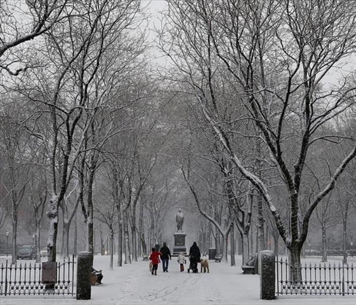 Winters in Boston can get pretty intense if you are not prepared you could be in for some trouble. Know the warnings and be ready
WE are in the thick of winter here in New England. With all the weather we have already had we thought it would be a good idea to keep you up to date with all the watches, warnings, and advisories that can be issued. They can be confusing and if you do not know which one is worse you could be in some trouble.
Hazardous Weather Outlook
The Hazardous Weather Outlook will describe potential hazardous weather and hydrologic information of concern in Days 1 through 7.
The outlook contains two segments: One segment for the marine zones and adjacent land-based (i.e., coastal) zones and the other segment for the rest of the land-based zones. Each segment of the HWO will contain 3 sections: short term through Day 1, long term for Days 2-7, and spotter information.
Winter Storm Watch
A Winter Storm Watch is issued when there is the potential for significant and hazardous winter weather within 48 hours. It does not mean that significant and hazardous winter weather will occur...it only means it is possible.
Significant and hazardous winter weather is defined as a combination of: 1) 5 inches or more of snow/sleet within a 12-hour period or 7 inches or more of snow/sleet within a 24-hour period AND/OR 2) Enough ice accumulation to cause damage to trees or powerlines. AND/OR 3) a life threatening or damaging combination of snow and/or ice accumulation with wind.
The snow/sleet criteria for a Winter Storm Watch for the five westernmost counties (Allegany, Mineral, Grant, Pendleton, and Highland) is higher (6 inches or more within a 12-hour period; 8 inches or more within a 24-hour period).
Blizzard Warning
A Blizzard Warning means that the following conditions are occurring or expected within the next 12 to 18 hours. 1) Snow and/or blowing snow reducing visibility to 1/4 mile or less for 3 hours or longer AND 2) Sustained winds of 35 mph or greater or frequent gusts to 35 mph or greater. There is no temperature requirement that must be met to achieve blizzard conditions.
Winter Storm Warning
A Winter Storm Warning is issued when a significant combination of hazardous winter weather is occurring or imminent.
Significant and hazardous winter weather is defined as a combination of: 1) 5 inches or more of snow/sleet within a 12-hour period or 7 inches or more of snow/sleet within a 24-hour period AND/OR 2) Enough ice accumulation to cause damage to trees or powerlines. AND/OR 3) a life threatening or damaging combination of snow and/or ice accumulation with wind.
The snow/sleet criteria for a Winter Storm Warning for the five westernmost counties (Allegany, Mineral, Grant, Pendleton, and Highland) is higher (6 inches or more within a 12-hour period; 8 inches or more within a 24-hour period).
Ice Storm Warning
¼ inch or more of ice accumulation.
Winter Weather Advisory
A Winter Weather Advisory will be issued for any amount of freezing rain, or when 2 to 4 inches of snow (alone or in combination with sleet and freezing rain), is expected to cause a significant inconvenience, but not serious enough to warrant a warning.
If the event is expected to impact the Baltimore/Washington metro areas during rush hours (4-9 am or 2-7 pm on weekdays) forecasted snow totals of one inch will necessitate the issuance of a winter weather advisory. The snow/sleet criteria for a Winter Weather Advisory for the five westernmost counties (Allegany, Mineral, Grant, Pendleton, and Highland) is higher (3-5 inches).
Freeze Watch
A Freeze Watch is issued when there is a potential for significant, widespread freezing temperatures within the next 24-36 hours.
A Freeze Watch is issued in the autumn until the end of the growing season (marked by the occurrence of first widespread freeze). The normal end of the growing season is mid to late October west of the Blue Ridge and early November east of the Blue Ridge. However, during anomalously warm autumns, the growing season may be extended past the normal end of the growing season.
A Freeze Watch is issued in the spring at the start of the growing season (when it is late enough to cause damage to new plants and crops).
Freeze Warning
A Freeze Warning is issued when significant, widespread freezing temperatures are expected.
A Freeze Warning is issued in the autumn until the end of the growing season (marked by the occurrence of first widespread freeze). The normal end of the growing season is mid to late October west of the Blue Ridge and early November east of the Blue Ridge. However, during anomalously warm autumns, the growing season may be extended past the normal end of the growing season.
A Freeze Warning is issued in the spring at the start of the growing season (when it is late enough to cause damage to new plants and crops).
Frost Advisory
A Frost Advisory is issued when the minimum temperature is forecast to be 33 to 36 degrees on clear and calm nights during the growing season.
A Frost Advisory is issued in the autumn until the end of the growing season (marked by the occurrence of first widespread freeze). The normal end of the growing season is mid to late October west of the Blue Ridge and early November east of the Blue Ridge. However, during anomalously warm autumns, the growing season may be extended past the normal end of the growing season.
A Frost Advisory is issued in the spring at the start of the growing season (when it is late enough to cause damage to new plants and crops).
Wind Chill Advisory
A Wind Chill Advisory is issued when wind chills of -5F to -19F are expected east of the Blue Ridge Mountains, and when wind chills of -10 to -24F are expected along and west of the Blue Ridge Mountains and in Frederick and Carroll Counties in Maryland.
Wind Chill Warning
A Wind Chill Warning is issued when wind chills of -20F or lower are expected east of the Blue Ridge Mountains, and when wind chills of -25F or lower are expected along and west of the Blue Ridge Mountains and in Frederick and Carroll Counties in Maryland.
Courtesy of our friends over at the National weather service. You can visit their website at
www.weather.gov for more information and to stay up to date on the latest weather for your area.